




2 November 2026
Auto-mapping: how accurately does it define the lawn?
Automatic mapping can reduce installation work, but completing a map is only the first step. The result needs to represent the intended mowing area accurately, account for difficult boundaries and provide a dependable basis for regular mowing.
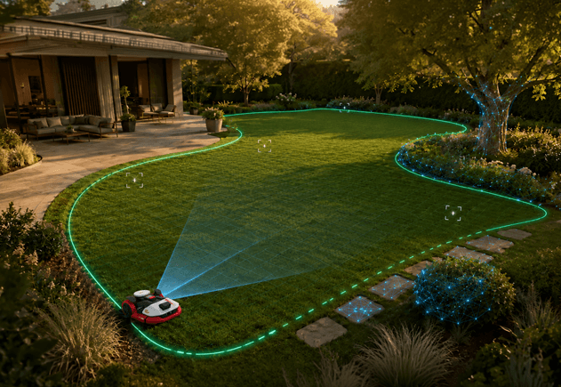
Quick answer
Auto-mapping allows a compatible robotic mower to create a digital map of the lawn with less manual guidance. Its value depends on the accuracy and completeness of that map, together with the amount of correction required.
A map that excludes part of the lawn can leave grass outside the mowing area. A map that extends beyond the intended boundary may include planting beds or other areas that should be excluded.
In the 2026 SGS comparison, Kress EyePilot received the highest auto-mapping score at 4 out of 5. It also led the professional mapping assessment, while all four mowers received the same manual mapping score.
What automatic mapping contributes
A wire-free mower needs a defined working area. The map establishes the boundaries within which it should mow and can form part of a wider configuration that includes separate zones, connecting routes and excluded areas.
Automatic mapping reduces the need for the owner or installer to guide the mower around the entire boundary manually.
Depending on the product, the process may combine satellite positioning, camera-based perception, movement measurements and mapping software. These inputs perform different tasks: positioning helps establish where the mower is, while perception can help identify the transition between the lawn and its surroundings.
RTK positioning alone does not identify where grass ends or which areas the owner intends to include. The mapping system needs to turn the available information into a suitable working boundary.
Why some lawn edges are harder to interpret
A lawn does not always end at a continuous, clearly visible line.
Grass beside paving may provide a distinct transition. Elsewhere, the edge may merge into soil, mulch, low planting or vegetation extending over the lawn.
Corners, irregular shapes and narrow sections add further demands. The mower needs to follow the intended outline without excluding accessible grass or extending the map into an adjacent area.
| Boundary feature | What the mapping system needs to resolve |
|---|---|
| Grass beside paving | Where the surfaces meet and where the working boundary should lie |
| Grass beside soil or mulch | A less distinct transition between the lawn and the adjacent area |
| Overhanging vegetation | The relationship between visible vegetation and the intended lawn edge |
| Corners and irregular edges | Changes in direction without losing part of the intended mowing area |
| Narrow sections | Whether and how the section belongs within the working map |
A successful demonstration along one clear edge therefore provides only part of the picture. Gardens containing several boundary types place broader demands on automatic mapping.
What makes a useful map?
An accurate boundary
The mapped boundary should correspond to the intended working area.
If it sits too far inside the lawn, the mower may leave an avoidable strip outside its mowing zone. If it extends too far out, the map may include ground that should not be treated as lawn.
The objective is an appropriate boundary for the property and the mower’s operating requirements.
Complete coverage
A map can look plausible while omitting a corner, a narrow section or a connected patch of grass.
These omissions matter because the mower uses the map during subsequent operation. An area excluded at setup may remain outside the regular mowing task until the configuration is corrected.
Reviewing the complete outline is therefore more useful than checking only whether the automatic process has finished.
Limited correction
Automatic mapping should reduce the work required to establish a usable map.
Some adjustments may reflect the owner’s preferences, such as adding an exclusion zone or dividing the lawn into separate mowing areas. Others may be needed to correct a missed section or an incorrectly placed boundary.
The distinction matters. Customising a suitable map is different from having to redraw much of it.
Close mapping does not guarantee cutting to the edge
Mapping accuracy and edge-cutting performance are related, but they are not the same.
The map defines where the mower can operate. The final cut also depends on the position of the cutting system within the mower, the clearance it needs and the physical character of the edge.
Grass beside a level paved surface presents a different situation from grass against a wall or raised border. Even an accurately mapped boundary may leave some grass that requires trimming.
Auto-mapping should therefore be assessed on whether it defines an appropriate working area. Claims about the finished edge need to account for the mower’s cutting design and the garden itself.
What mapping behaviour can tell you
During automatic mapping, a mower may adjust its route, revisit an edge or take additional time around a difficult section.
Those actions do not, by themselves, establish that the system is inaccurate. An adjustment may improve the final result.
Equally, completing the route in one attempt does not prove that every boundary has been placed correctly.
The more useful assessment considers the whole process: whether mapping was completed, how accurately the result represents the intended lawn and how much intervention was needed before the map could be used.
For the owner, the practical benefit is a suitable working map produced with less effort.
What the SGS comparison showed
The 2026 SGS comparison assessed automatic, manual and professional mapping as separate performance categories.
Kress EyePilot received 4 out of 5 for auto-mapping, ahead of Mower B and Mower C, which each received 3 out of 5.
The other mapping assessments provide useful context:
| Mapping assessment | Kress EyePilot | Mower A | Mower B | Mower C |
|---|---|---|---|---|
| Manual mapping | 4 | 4 | 4 | 4 |
| Professional mapping | 5 | 4 | 3 | 2 |
Scores are out of 5.
Manual mapping produced no separation between the four systems. Kress received the highest professional mapping score at 5 out of 5, as well as leading the auto-mapping assessment.
These results matter because different gardens may benefit from different installation approaches. Automatic mapping can reduce setup work, while professional mapping gives trained dealers and installers another way to configure more complex properties.
Across all 12 performance categories, Kress EyePilot achieved the highest overall score at 4.5 out of 5.
The scores describe performance under the defined SGS conditions. They do not establish that every garden can be mapped automatically without review or adjustment.
When manual or professional mapping is useful
Automatic mapping is one installation option. Its suitability depends on the layout and the clarity of the intended boundaries.
A property may contain areas that look similar but need different treatment. The owner may want to exclude a particular patch, define a connecting route or configure several lawn zones.
Manual controls allow those decisions to be reflected in the map. Professional installation can also help where the layout requires closer assessment.
For homeowners, access to a specialist dealer is relevant here. The dealer can assess the property, select an appropriate mapping approach and help confirm that the finished configuration matches the intended mowing area.
What buyers should ask
Before choosing a mower for its auto-mapping capability, ask:
1. Can it map the mixture of boundaries present in my garden?
2. How does it handle corners, narrow sections and vegetation near the edge?
3. Can I review and edit the completed map?
4. How are separate lawn zones and excluded areas configured?
5. What manual or professional mapping options are available?
6. How much edge trimming should I expect after installation?
The answers help distinguish installation convenience from the quality of the finished mowing result.
Conclusion
Automatic mapping is useful when it produces an accurate, complete working map with less effort from the owner.
Kress EyePilot led both the automatic and professional mapping assessments in the SGS comparison, while matching the other tested mowers on manual mapping.
That range of capability gives buyers more than one route to a well-configured lawn. The appropriate approach depends on the garden, its boundaries and the support required during installation.
Frequently asked questions
No. Wire-free operation and automatic mapping are separate capabilities. Depending on the product, the boundary may be established automatically, through manual guidance or by a professional installer.
Some systems use camera-based perception and other inputs to help interpret lawn boundaries. Performance depends on the product and the conditions. Grass merging into planting or vegetation can present a different challenge from a clearly defined paved edge.
No. RTK helps the mower calculate its position. Identifying the lawn edge and deciding where to place the working boundary require additional information or input from the owner or installer.
Not necessarily. A map may need correction or customisation before regular mowing. The practical measure is how much work remains after the automatic process and whether the result accurately represents the intended area.
Not necessarily. Edge coverage also depends on the mower’s cutting design, required clearance and the physical boundary. Some edges may still need trimming.
Kress EyePilot received the highest auto-mapping score at 4 out of 5 and the highest professional mapping score at 5 out of 5. All four tested mowers received 4 out of 5 for manual mapping.
Share this article


Can robotic mowers handle narrow passages, dead ends and multi-zone gardens?
See how robotic mowers navigate narrow passages, dead ends and separate lawn zones.
9 November 2026
Obstacle detection: what matters in a real garden?
Detection is only the first step. See what effective obstacle avoidance requires in a real garden.
26 October 2026

Why RTK alone is not enough for robotic mowing
Precise positioning is only the beginning. Discover what robotic mowers need to navigate independently.
19 October 2026
What happens when a robotic mower loses RTK signal?
Trees, buildings and interrupted correction data can weaken positioning. See how robotic mowers respond.
12 October 2026

Network RTK vs. local base-station RTK: what is the difference for robotic mowers?
Two routes to precise, wire-free mowing. Discover how Network RTK differs from a local base station.
5 October 2026

Four premium robotic mowers compared in the 2026 SGS test
Four premium robotic mowers. Twelve real-world SGS tests. See which came out on top.
11 September 2026


