




12 October 2026
What happens when a robotic mower loses RTK signal?
Trees, buildings and interrupted correction data can reduce the precision of satellite positioning. Whether a robot mower continues working, pauses or needs help depends on its complete navigation system.
Quick answer
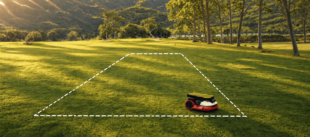
When an RTK robotic mower can no longer determine its position with sufficient confidence, it may slow down, pause or stop until conditions improve. Some systems use additional sensors and localisation methods to continue through temporary interruptions.
“Lost RTK signal” can describe two different situations: the mower cannot receive enough reliable satellite observations, or it cannot receive the correction data used to refine those observations.
Both can affect positioning accuracy. Neither tells you, by itself, how the mower will respond.
For homeowners, the practical question is whether the mower can manage the interruption, maintain coverage and resume normal operation without assistance.
Why satellite reception changes around a garden
RTK improves the precision of positioning calculated from Global Navigation Satellite System, or GNSS, signals. It combines the mower’s satellite observations with correction data from reference stations at known locations.
Both inputs matter. Correction data cannot replace satellite observations that the mower is unable to receive.
An open lawn may provide good sky visibility, while other parts of the same garden present more difficult conditions:
• Tree cover can weaken or block satellite signals.
• Buildings, walls and roof edges can obstruct part of the sky.
• Nearby surfaces can reflect signals before they reach the receiver.
• Narrow passages may combine restricted sky visibility with reflected signals.
Reflected signals can introduce errors into the position estimate, an effect known as multipath.
Reception is therefore not simply available or unavailable. A mower may still receive satellite signals and calculate an approximate position without having the precision required to follow its mapped boundaries and mowing lines confidently
Satellite reception and correction data are different
The phrase “RTK signal loss” often combines two separate problems.
| Situation | What has changed | Why it matters |
|---|---|---|
| Reduced GNSS reception | The mower receives fewer reliable satellite observations because signals are obstructed, weakened or reflected. | The observations needed for precise positioning become less reliable. |
| Interrupted RTK corrections | The mower may still receive satellite signals, but fresh correction data is unavailable. | The mower loses an input used to refine its satellite-based position. |
A local base-station system depends on its reference station and the communication link to the mower.
Network RTK depends on an external correction service and a data connection.
Neither approach removes the mower’s need for adequate satellite reception.
The distinction is useful when assessing a garden. Improving connectivity may help an interrupted correction stream, but it will not remove a building that obstructs the mower’s view of the sky.
What the mower may do next
The response depends on the product, the duration of the interruption and the other positioning information available.
A mower may pause until it can establish its position more reliably. Where supporting sensors provide sufficient information, it may continue through the affected area. If its position estimate becomes less accurate, mowing quality may suffer through missed strips, unnecessary overlap or poorly aligned paths.
Stopping is not automatically evidence of an inferior system. It can be the appropriate response when the mower cannot determine its position confidently enough to continue.
The more useful assessment is how effectively the system manages the complete event: entering the affected area, deciding whether to proceed, maintaining coverage where possible and recovering afterwards.
Repeated stops that require the owner’s help have a different practical consequence from a short pause followed by an automatic restart.
How other sensors support navigation
Manufacturers may combine satellite positioning with cameras, motion sensors and wheel movement measurements. Combining information from several sources is commonly called sensor fusion.
Each source contributes something different.
Visual localisation uses features in the surrounding environment to help estimate position and movement. One approach is visual simultaneous localisation and mapping, or V-SLAM, which uses camera observations to build or update a map while estimating the mower’s position within it.
Inertial sensors measure changes in motion and rotation, helping the system estimate how the mower is moving.
Wheel odometry estimates travel from wheel rotation.
These inputs can support dead reckoning: estimating the current position from a previously known position and subsequent movement.
Camera-based perception can also help identify grass, boundaries and obstacles. Recognising an object, however, is a different task from establishing the mower’s precise position within its lawn map.
The exact combination of technologies, and how the mower uses them, varies by product. A list of sensors alone does not establish how reliably the complete system will operate.
Why recovery matters
Supporting localisation methods have limits. Wheel slip can affect movement estimates, while changes in the scene or limited visual features can make visual localisation more difficult. Errors may accumulate as the mower travels.
When reliable RTK positioning becomes available again, the navigation system can use it to correct its position estimate and continue along the planned route.
This matters because difficult reception may be confined to one part of a garden. A mower might pass beneath trees or beside a building before returning to an open area.
Managing that transition well can reduce interruptions and missed cutting. Continuing for longer is useful only if the mower also maintains sufficient control and mowing quality.
There is therefore no single signal-loss duration that describes every RTK mower or every garden.
What the SGS comparison showed
The 2026 SGS comparison assessed four premium robotic mowers across 12 areas of performance, including operation with reduced GNSS reception.
In the signal-loss assessment, SGS considered shutdowns, missed cutting, efficiency and the alignment of the mowing pattern.
| Mower | Signal-loss recovery score |
|---|---|
| Kress EyePilot | 4 out of 5 |
| Mower B | 4 out of 5 |
| Mower C | 3 out of 5 |
| Mower A | 1 out of 5 |
Kress EyePilot and Mower B shared the highest score in this category.
All four mowers received 5 out of 5 for path accuracy in the separate open-area test. The signal-loss results show why accurate mowing in open conditions is only one part of the assessment.
Across the complete comparison, Kress EyePilot achieved the highest weighted overall score at 4.5 out of 5.
These results describe performance under the defined SGS test conditions. They do not establish that any mower can operate indefinitely without satellite reception, or that one supporting technology alone accounts for the result.
What buyers should ask
A garden with mature trees, tall buildings or narrow connecting passages deserves a closer assessment than the term “RTK” alone can provide.
Before choosing a mower, ask:
1. Which parts of my garden may have restricted satellite reception?
2. How does the mower receive correction data, and will that connection reach every lawn zone?
3. What does the mower do when satellite reception or correction delivery is interrupted?
4. Which additional localisation methods support it in those conditions?
5. Can it resume mowing automatically, or might it require assistance?
6. Can a specialist dealer assess the difficult areas before installation?
The answers help connect the mower’s capabilities to the conditions in which it will actually work.
Conclusion
RTK provides a precise positioning foundation, but satellite reception and correction delivery can vary around a property.
The mower’s wider navigation system determines how it manages those changes: whether it can continue, when it needs to pause and how effectively it recovers.
Kress EyePilot shared the highest signal-loss recovery score in the SGS comparison and achieved the highest weighted overall result. For buyers, this reinforces the value of assessing the complete mower across the challenges their garden presents.
Frequently asked questions
They can, but performance depends on the extent of the tree cover, satellite visibility and the mower’s supporting localisation methods. Dense or overlapping foliage may create more difficult conditions. A dealer assessment can help establish suitability for a particular garden.
GPS is one of the satellite systems covered by the term GNSS. If reliable satellite positioning becomes unavailable, a mower may pause or use other localisation inputs to continue for a limited period. Its response depends on the product and operating conditions.
Yes, although buildings can obstruct and reflect satellite signals. A narrow passage between tall structures may be more demanding than an open lawn beside a single wall. Performance depends on the layout and the mower’s complete navigation system.
For a Network RTK mower, an interrupted data connection may prevent fresh correction data from reaching the mower even when satellite reception remains available. A local base-station system may use a separate communication link. The effect depends on how the product receives its corrections.
There is no universal duration. It depends on the supporting sensors, the environment, movement since the last reliable position and the system’s operating limits. Continued movement alone does not establish that mowing remains accurate.
Kress EyePilot and Mower B shared the highest signal-loss recovery score at 4 out of 5. Kress achieved the highest overall score across the complete comparison at 4.5 out of 5.
Share this article


Can robotic mowers handle narrow passages, dead ends and multi-zone gardens?
See how robotic mowers navigate narrow passages, dead ends and separate lawn zones.
9 November 2026
Auto-mapping: how accurately does it define the lawn?
Creating a map is only the beginning. Discover what makes robotic mower auto-mapping truly reliable.
2 November 2026
Obstacle detection: what matters in a real garden?
Detection is only the first step. See what effective obstacle avoidance requires in a real garden.
26 October 2026

Why RTK alone is not enough for robotic mowing
Precise positioning is only the beginning. Discover what robotic mowers need to navigate independently.
19 October 2026
Network RTK vs. local base-station RTK: what is the difference for robotic mowers?
Two routes to precise, wire-free mowing. Discover how Network RTK differs from a local base station.
5 October 2026
Four premium robotic mowers compared in the 2026 SGS test
Four premium robotic mowers. Twelve real-world SGS tests. See which came out on top.
11 September 2026


