

KR276 Kress EyePilot® RTKⁿ 2.5 acre robotic lawn mower with ZeroTrim with integrated 4G

  • Home
  • Robotic lawn mowers
  • Kress EyePilot® RTKⁿ 2.5 acre robotic lawn mower with ZeroTrim with integrated 4G

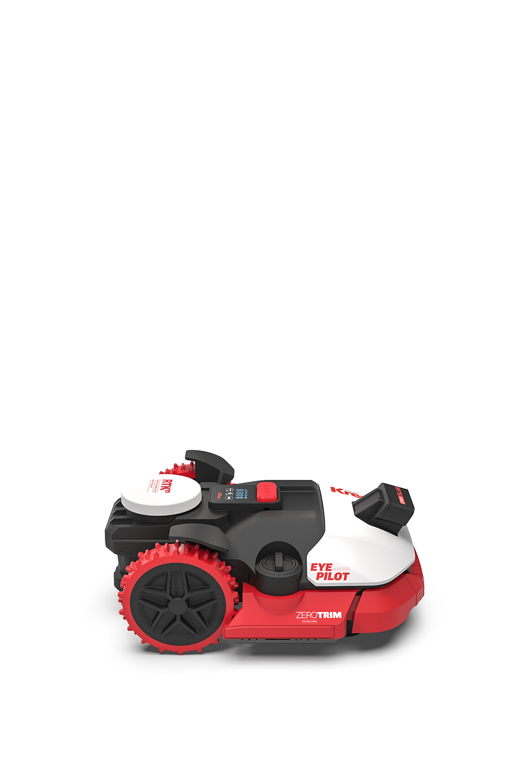
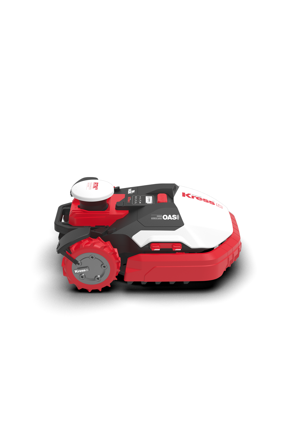
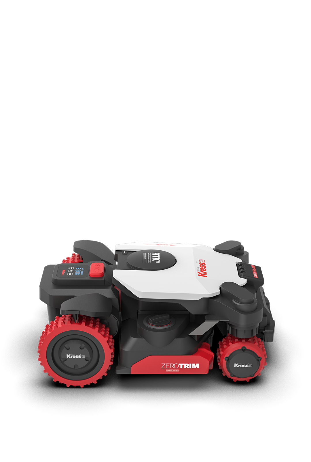
Delivering course-grade lawn care, the Kress EyePilot® RTKⁿ KR276 2.5 acre robotic mower uses RTKⁿ satellite positioning combined with vision-based awareness to deliver, accurate navigation across differnt lawns — without added hardware. RTKⁿ correction is delivered over the air and reinforced by a redundant positioning architecture, allowing the mower to maintain accuracy even when satellite signals are compromised. The ZeroTrim cutting system delivers clean, precise edge cutting, reducing the need for manual trimming. Mowing patterns can be set for defined stripes or a more natural finish. EyePilot remains reliably connected via Wi-Fi or integrated 4G. With no ongoing costs, the system stays connected, updated, and trackable. Learn more › Learn less

$ 3,599.99
Find a dealer
Key features
  • EyePilot® vision-based awareness for wire-free setup
  • Intelligent obstacle awareness
  • Stable navigation in shaded and complex environments
  • ZeroTrim cutting system for precise edge cutting
  • RTK-guided operation
  • Centimeter-level accuracy without added hardware
  • Structured or random mowing paths
  • Consistent cutting performance in dense grass
  • Mowing capacity of up to 2.5 arce in 48 hours
  • Integrated 4G connectivity for reliable coverage in large and complex lawn
  • Multi-zone management with precise routing between lawn areas
  • Flexible lawn mapping options: automatic, assisted, or app-based mapping
  • Quiet operation at just 62 dB
  • Self-leveling cutting system
  • Digitally adjustable cutting height
Technical specifications
Fleet management
1
Charging current
5 A
Battery voltage
20 V
Cutting height adjustment
Electric
Cutting blades
4
Self-leveling blade disc
1
Cutting methods
Logic
Cutting width
8.7 in
Cutting height steps
9.5 in
USB
1
Charging current
5 A
Cutting width
8.7 in
Cutting height steps
9.5 in
Wi-Fi/Bluetooth
1
4G
1
PIN code
1
Lift sensor
1
Auto lock
1
App
1
Weight
29.76 lbs
Maximum slope
40%
Sound level perceived
62 db
Front wheels
2
Weather resistant
1
Hose cleaning
1
Quick return
1
Water protection index (IP code)
IPX6
In the box
Screw for fixing blades
16
Charger with 10m extension cable
1
Charging base fixing nails
8
Hex keys
1
Measurement gauge
2
Spare blades
16
Battery
1
Charger
1
Charging tower
1
Charging base
1
EyePilot robotic lawn mower
1
Manual and documents FAQ
What is the difference between RTKⁿ and local RTK?
Kress RTKⁿ and local RTK use the same basic principle: the mower receives GNSS (Global Navigation Satellite System) satellite signals and combines them with real-time correction data to calculate a centimetre-level position. The main difference is where the corrections come from and how they reach the mower. Local RTK uses one reference station installed at the mowing site. The station requires a suitable location, power and setup, and normally sends corrections directly to the mower through radio or another local communication link. Its operation depends on that single station. Kress RTKⁿ uses a correction network built from multiple permanent reference stations. The network calculates the corrections and sends them to the mower over the internet through Wi-Fi or 4G. No local reference station needs to be installed or maintained. Compared with standard GNSS/GPS or even dual-band, triple-band GNSS, the full-band GNSS Kress Eyepilot applied can receive a wider range of satellite frequency bands, helping improve the quality and availability of the satellite positioning input before correction is applied. However, this is a receiver capability rather than the defining difference between network and local RTK. Both systems still require the mower to receive GNSS satellite signals. Kress RTKⁿ removes the local base station, but both local RTK and an RTK network can be affected by GNSS signal obstruction from trees and buildings.
How does Kress RTKⁿ differ from local RTK solutions in robotic mowers?
RTKⁿ and local RTK both improve GNSS positioning accuracy by using RTK correction data, but they use different correction-data solutions. Local RTK relies on a local base station installed at the mowing site. The base station provides RTK correction data to the mower, enabling centimeter-level positioning within a limited area. However, users need to install, position, power, and maintain the local base station. Any change to the base station location, signal obstruction, or power interruption may affect positioning stability. Kress RTKⁿ uses a dedicated RTK network with multiple permanent reference stations instead of a single local base station. This expands network coverage and removes the need for users to install RTK hardware on-site. The mower receives correction data from the RTK network while the system continuously monitors reference station status, signal quality, and network performance. Compared with many third-party RTK networks, Kress RTKⁿ is designed specifically for robotic mowing. With Kress-managed reference stations, built-in redundancy, and 24/7 monitoring, the network helps maintain stable centimeter-level positioning and reliable operation across different environments.
How does the reference-station network work in robotic mowing?
A reference-station network provides the real-time correction data that allows a robotic mower to determine its precise position without a local RTK base station. The network consists of multiple permanent CORS (Continuously Operating Reference Stations) whose exact coordinates are established through geodesy. Both the mower and the CORS receive GNSS satellite signals. Because each CORS knows its true position, it can identify the errors in the position calculated from those signals. A central correction network collects observations from multiple CORS and models how GNSS errors vary across the operating area. It then generates correction data for the mower’s location and sends it over the internet. The mower’s positioning engine combines its own GNSS measurements with these corrections to calculate a centimetre-level position on the lawn map. This precise position enables the mower to follow planned mowing lines, respect virtual boundaries and navigate between lawn zones. This allows the mower to follow planned mowing lines, respect virtual boundaries and navigate between lawn zones. The Kress reference-station network also eliminates on-site reference-station installation. Built and operated by Kress, it provides 24/7 correction service with no user maintenance required.
Can Kress Eyepilot work under tree cover or with weak satellite signal?
When the mower moves under trees, near walls, buildings, or narrow passages, satellite reception may become weak, blocked, reflected, or delayed. This can make GNSS/RTK positioning less stable. In these conditions, the mower does not rely on RTKⁿ alone. V-SLAM uses the onboard camera to recognize visual landmarks, such as lawn edges, trees, paths, flower beds, walls, or other fixed features. By comparing these visual features with the lawn map, the mower can estimate where it is and how it is moving. At the same time, inertial navigation uses the mower’s IMU (Inertial Measurement Unit) to track motion, rotation, heading changes, and acceleration. Wheel odometry adds information about wheel movement and distance traveled. Through sensor fusion, the mower combines satellite positioning, visual localization, IMU data, and wheel odometry to maintain a stable position estimate when satellite signals are temporarily limited. This is why Kress Eyepilot can operate reliably under trees, near walls, or in areas where RTK signals are partially blocked: it combines RTKⁿ positioning with V-SLAM navigation and inertial sensing, instead of relying on a single positioning technology.

From the world’s finest courses to your garden

4×4 or rear-wheel drive, depending on your environment.

What you see is what you pay

Connectivity is included from the start — whether via Wi-Fi or integrated 4G.

No additional fees. No surprises.

Learn more

Precision without intrusion

RTK correction delivered over the air — no antennas, no poles, nothing added to your garden.


We gave it awareness

RTK precision, enhanced by vision AI.


Accuracy that corrects itself

Kress EyePilot continuously maintains precise positioning in real time.


Redundant positioning architecture

If satellite signals are weakened, sensor fusion maintains accurate positioning.


Sees what doesn’t belong

Anything that isn’t lawn is detected and avoided.


Uninterrupted by foliage

Fallen leaves are treated as ground cover, not obstacles.


Accurate at hardscape

Grass is identified correctly even when bordered by stone or paving.


Edges, completed

Cuts precisely to the edge, reducing the need for follow-up trimming.


Structured or random paths

Structured paths for stripes. Random paths for a natural finish. Both are supported, depending on preference.


Precise routing between lawn areas

RTK accuracy maintains consistent navigation between multiple lawn zones.


Precise in confined spaces

Maintains precise navigation through narrow and constrained areas.


Continues to evolve

Course-grade precision for your best lawn. Season after season.


Vision maintained after dark

The front lights provide additional illumination in low-light conditions, enabling safe operation after dark.


Quiet enough to disappear

Life indoors and out continues, undisturbed.


Configurable turf heights

Height is configured digitally for each lawn zone.


Configure and monitor operation

Software updates are delivered hands-off, no action required.


Trackable if removed from site

Location tracking allows the mower’s position to be viewed if it is moved outside the property.

Loading...
OPEN
ALL

Store Direction

GET DIRECTIONS

Use my location to find the closest Service Provider near me

Description